

Last fall we started planning a longer tour to do this summer and wanted to bring our own camping equipment to be more self-reliant and without the assistance of stopping at a hotels every night. This next step is a steady progression for an even longer future tour and who knows, maybe a cross-county tour in the next 5-10 years. So after some research, we decided we would ditch our typical road bikes and transition over to mountain bikes in order to ride the GAP trail from Pittsburgh to Cumberland Maryland, then continue on the C.&O. Canal Trail from Cumberland to Georgetown (Washington D.C.) This would be done over 5 days with a few extra side trips along the way which would add some additional miles, but we were not too concerned about the milage in 5 days. We were just happy to get out of lockdown at this point. This would be a change from our previous 2 tours where we had rode across Ohio (4 days) and Michigan (2 days) on road bikes and stopped at hotels each night. This tour we would carry our own camping supplies and about 55 lbs. in total of gear. This would mean we would be traveling with heavy panniers and purchasing many items we typically didn’t use very often or even had on hand. So we started securing these items through the winter and spring.
The June tour date was quickly approaching and the country & World was still amid the Covid lockdown. We were very concerned about the possibility of the tour even taking place. As March turned into early June, we noticed that the GAP trail and the areas surrounding the trail slowly started opening up and allowing cyclists access to the route. We made a decision that we were going to do the tour anyway and bring along extra bottles of water, toilet paper & masks so were were not as reliant on outside factors to complete our tour. After all, we had purchased all of this camping gear and we planned on using it.
Our quick overview itinerary would be as follows: June 18 we would drive to Pittsburgh, stay in a downtown hotel, park the van in a long term parking lot, ride our bikes to Georgetown (Washington DC) over 5 days, check out the National Mall, spend a night in a hotel in DC and then drive the rental car back to Pittsburgh and head home on June 24. Sounds simple right? If you don’t want to read the whole post, here are the 3 Youtube links. GAP Trail, C&O Trail Day 2&3, C&O Trail Day 3.
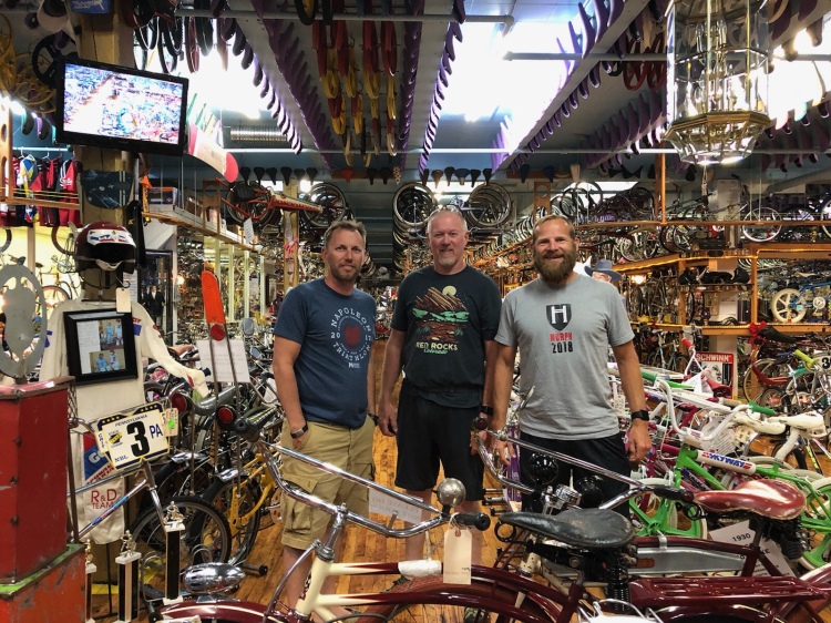
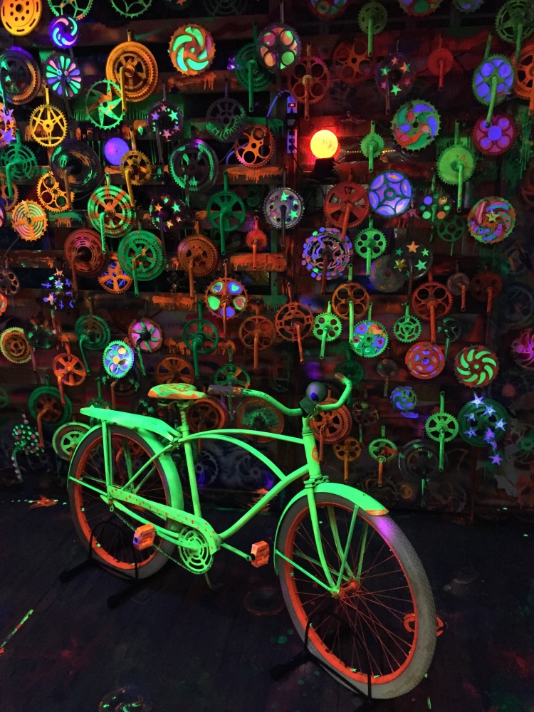
Day 0, Thursday June 18: Once arriving in downtown Pittsburgh we found one of the must interesting museums in the country in Bicycle Heaven. Bicycle Heaven is an active bike shop, but also houses one of the most unique & largest bicycle museums in the country. The pictures do not do justice to the amount of bikes on hand in this museum.


After leaving the bicycle museum, we needed to get a good meal so we stopped at Over the Bar Bicycle Cafe near downtown. Iron City beer and a meaty hamburger was a great way to fuel-up prior to our big adventure the following morning.

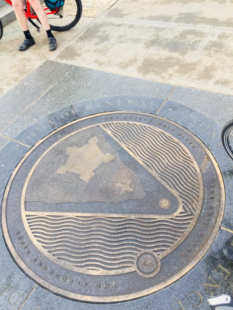
Day 1, Friday June 19: Pittsburgh to Ohiopyle, Pennsylvania. After a few pictures at mile marker 149 at the confluence of the three rivers (Allegheny, Monongahela & Ohio River), we headed out of the downtown Pittsburgh area and through a series of urban trails alongside the Monongahela River and several steel mills. The urban trail system was a pretty decent riding surface, but did have a steady amount of traffic until we got further east of Pittsburgh.


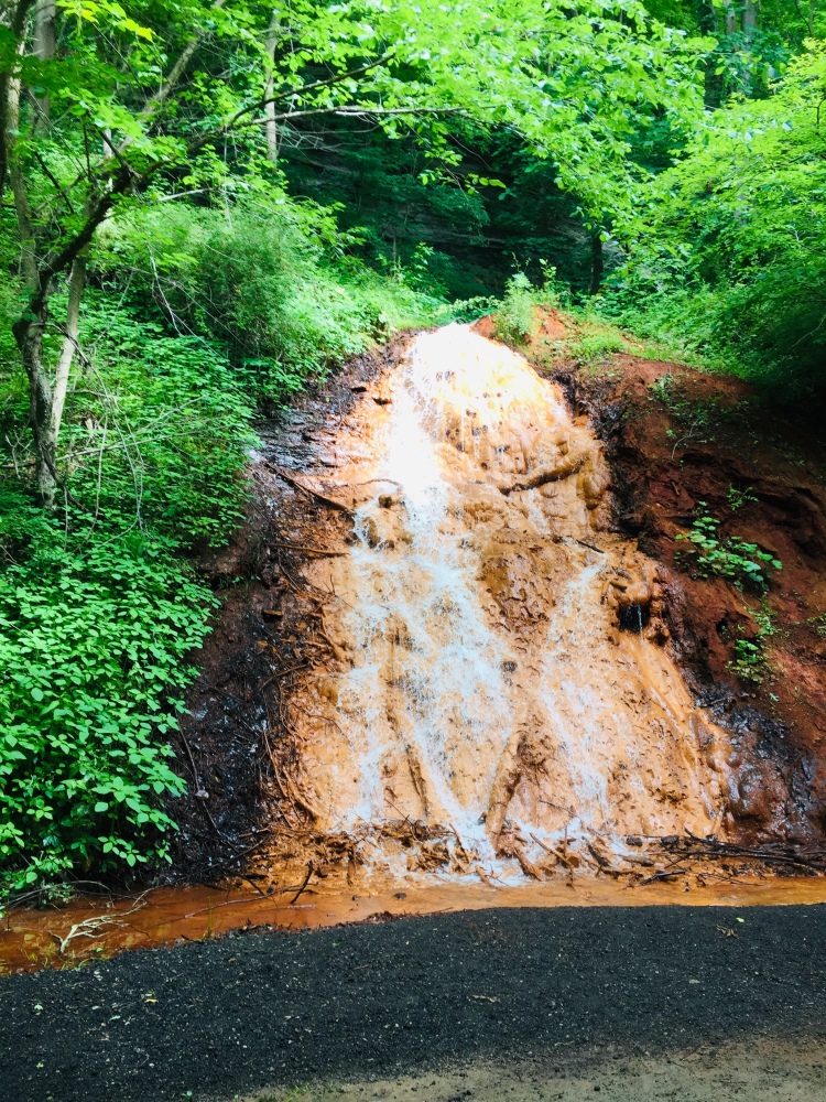
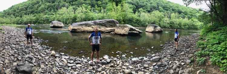
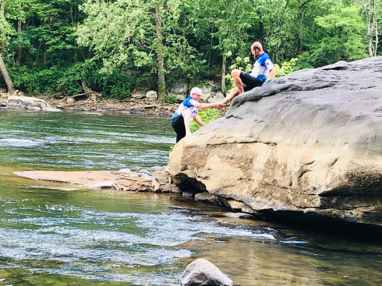
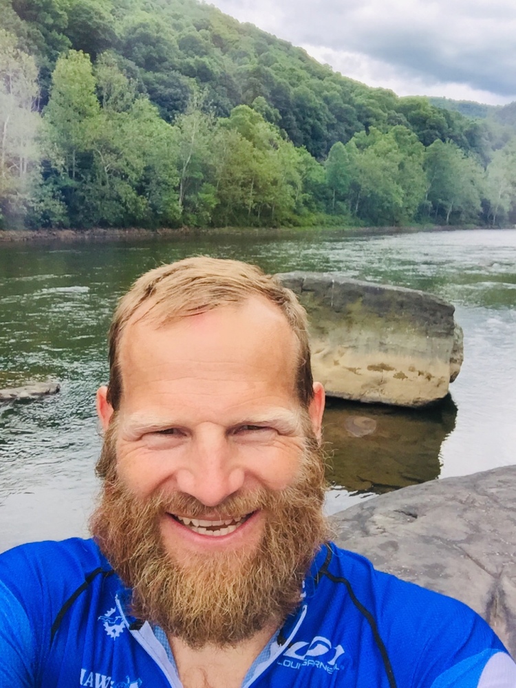
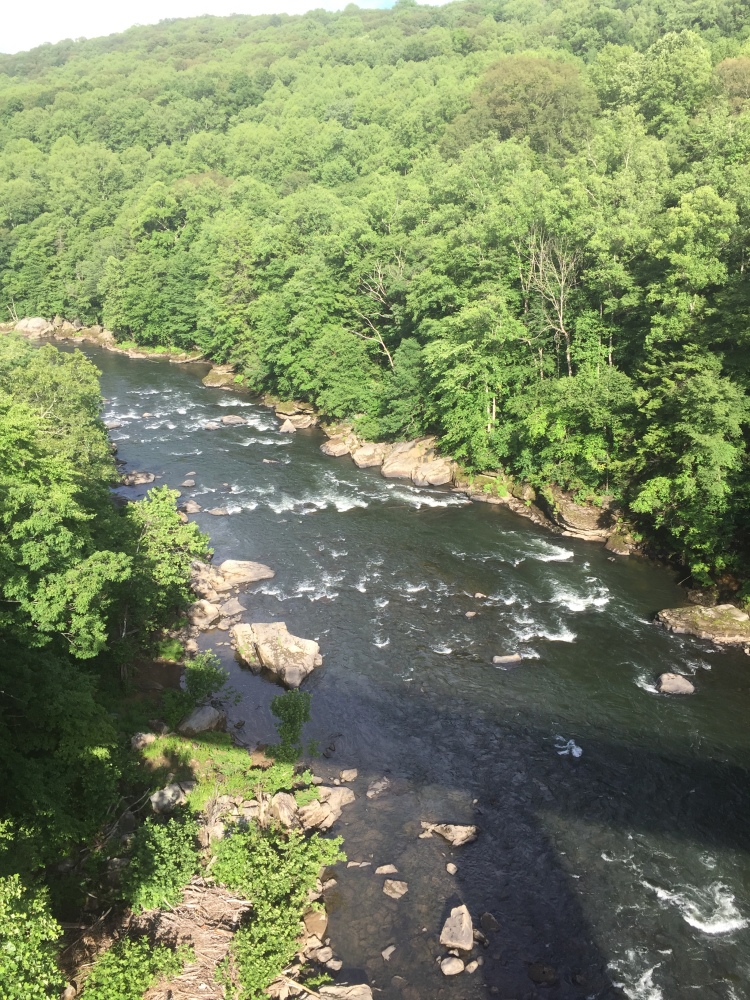
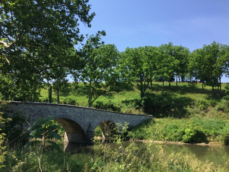
After making great time leaving Pittsburgh, the stretch of trail from Connellsville to OhioPyle was the prettiest area of the whole trip. This portion of the GAP Trail follows the Youghiogheny River, which is a shallow rocky river known for it’s kayaking and rafting. We constantly saw rafters and kayakers in the river, while continuing to pass other riders on the trail overlooking the river. There are quite a number of natural springs that come down from the mountain tops to create little waterfalls near the trail as well. We ended up taking a mid day break and walked down to the river to dip our feet in the water and have a snack. Once down in the river we started exploring all the rocks & boulders in the middle of the river. This was a new experience for us Northwest Ohio boys.
Once back on the trail we noticed the clouds darkening, but we kept moving thinking it wasn’t going to rain anymore than a light sprinkle. Before we knew it, it was pouring and we were completely soaked. We thought we could just ride through it and keep going instead of stopping and taking cover under a tarp we had brought along just for this particular situation. Wrong, we ended up riding about 10 miles through torrential rains and soaked everything we were wearing. Once we saw the sign for the Ohiopyle State Park – Kentuck Campground we were relived and thankful we could get something to eat and not to mention dry out.
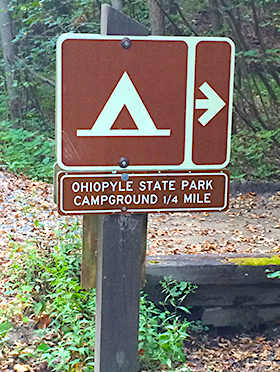
The problem was the connecting trail from the GAP to the actual campsite was up a freaking mountain. Notice that the sign says 1/4 mile, what that sign doesn’t say is it is up a 20% gradient with loose gravel the whole way. We thought it was odd that the second sign informed us to push our bikes up the hill. This was quite the arduous journey pushing our fully loaded bikes up this rocky and loose gravel hill in a downpour. My cycling shoes were not mountain bike shoes, they were road bike shoes with no grip whatsoever. So the slog up the hill was awful when every step I took seemed like my footing gave way to the mud and gravel sliding back down the hill. Eventually we reach the top and a were able to remount our bikes to ride to the the main office. The friendly lady informed us we indeed had secured the last campsite for the evening.
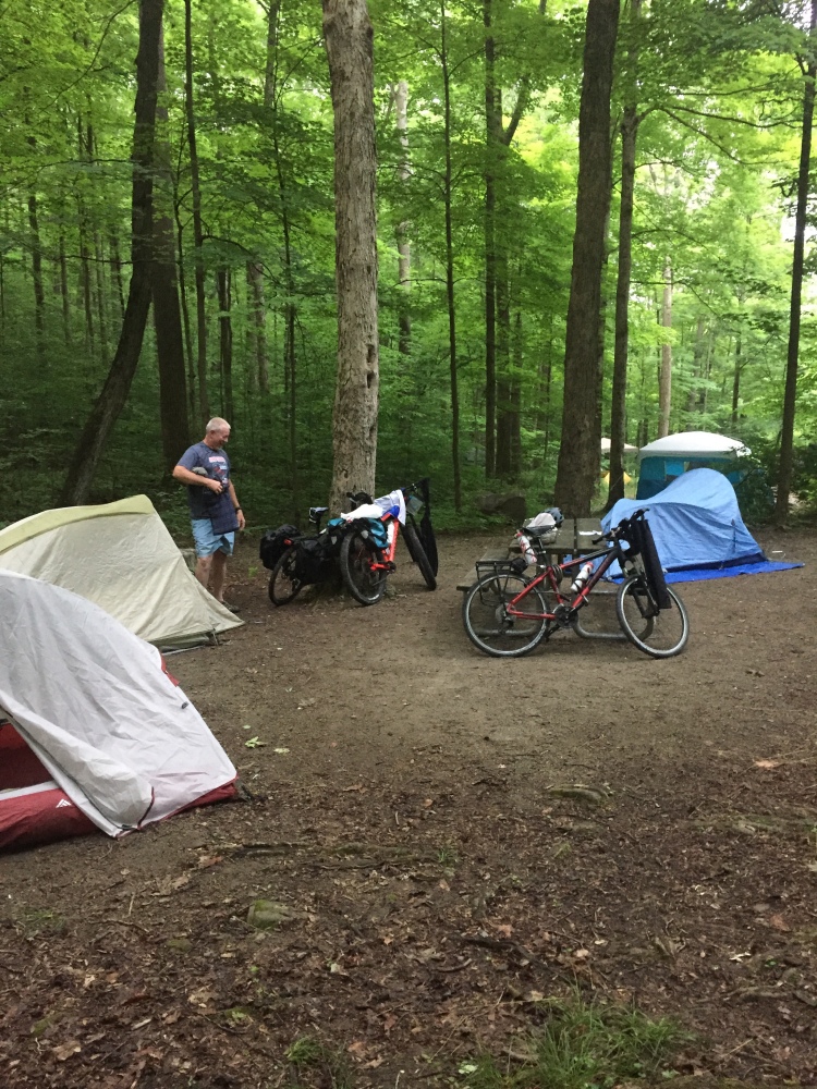
Once we checked-in to our campsite, we set up camp and started to try and dry everything out. Thankfully everything in our dry bags were indeed dry. My phone that was in the back of my cycling jersey… not so much. To our surprise, there was a wall hand dryer in the communal restroom near our campsite that worked wonders on drying socks, cycling shorts & jerseys. Once we showered and changed into dry clothes, we walked into town. We had come to the conclusion we would not be tacking that hill on our bikes again anytime soon. We would ride down the hill fully loaded the next morning. Definitely tricky, but we did it, but wouldn’t advise it for the faint of heart. Ohiopyle is a small but beautiful town with nearly everything catered to the outdoor tourist. Bike & kayak rentals are quite popular, but white water rafting is the main attraction for this town. They do have some small art and crafts shops, but everyone of the restaurants we ate at were wonderful.

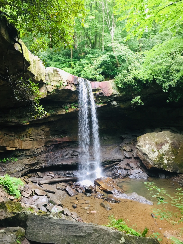
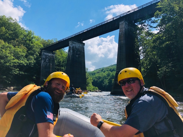
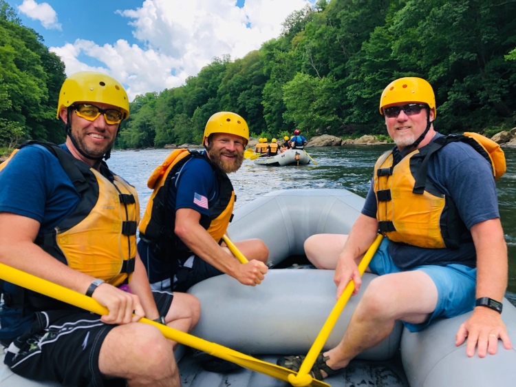
Day 2, Saturday June 18: After repacking our campsite into our panniers, we headed back into town to secure some breakfast and check out some of the points of interest in this awesome little town. We rode our bikes to Cucumber Falls before checking in with our rafting company to spend the day on the river. This was kinda an impromptu rafting trip since we had no idea how the weather would be or even if we would feel up to rafting after riding 80+ miles on the first day of the ride. We were so glad we had the opportunity though because the rafting trip was absolutely a blast.
The best part of the rafting experience is how it started. So Laurel Highlands Rafting fitted us up with all the typical rafting equipment and we practiced maneuvering the raft under the direction of the guide in the slack water area prior to hitting the first rapid. I will point out at this time, my buddies have both experienced white water rafting before, either in Montana or on the New River in West Virginia. I however am the rookie, so I was paying very close attention to the instructions our guide was giving us. The guide was telling us about how we will go over a series of 21 rapids this trip and some of them can be pretty tricky so we need to be prepared if someone happens to get thrown from the boat. As we leave the slack water practice area we hit the first rapid and our boat hits a large rock and comes to a complete & abrupt stop and one of my buddies does a header out of the boat into the river. That didn’t take long! Putting my newly acquired knowledge about pulling someone into the raft, I grab both of his shoulder straps and yank him back into the raft. The look on his face was priceless as he got back in the raft and we all had a good laugh about not making it past the first rapid and he gets tossed out.
After white water rafting we quickly grabbed lunch at the Ohiopyle Bakery & Sandwich Shoppe before leaving Ohiopyle. This was our second meal of the day here and the lunch was as good as the breakfast. Initially we only planned to cover about 40 miles since most of our day would be spent in a raft rather than in the saddle. We continued to make great time on the well maintained GAP trail and were able to ride in a paceline much of the ride.

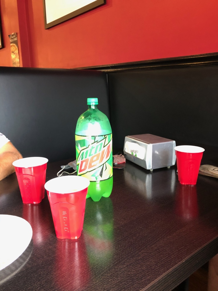
In late afternoon, we stopped in Meyersdale for supper and to look for a campsite to spend the night. We were pretty tired from being on the river and saddle most of the day. After a pizza, some bread sticks and a 2 liter of Mountain Dew at Fox’s Pizza, we made a group decision that we would cover as much ground as we could until it got dark. We knew we would make it to the Eastern Continental Divide, but didn’t know if we would be able to make it down the other side of the divide and cruise into Cumberland before it got dark. We were pot committed and wanted to give it a try, especially since we couldn’t seem to find any campsites in this portion of the trail.

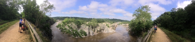
The Eastern Continental Divide is a highlight for many riders who are riding the whole trail (GAP and C&O Canal Trails), because this means that you are roughly halfway through the ride. This also means a steady 25 mile downhill from the divide into Cumberland. We didn’t stick around too much to enjoy the view on the top due to being afraid of losing daylight. We ran a paceline the whole way down the mountain hitting 20+ mph the whole way down with our heavily loaded bikes as it was getting dark. This was probably not our best idea for the trip, but when you have a nice downhill you just go with it.
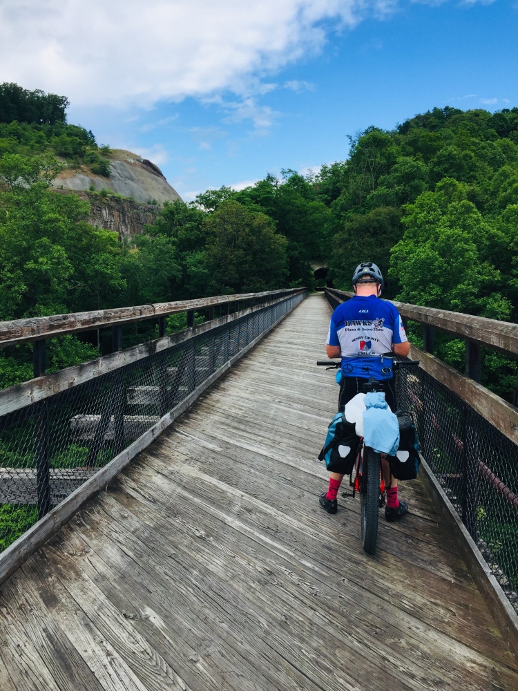
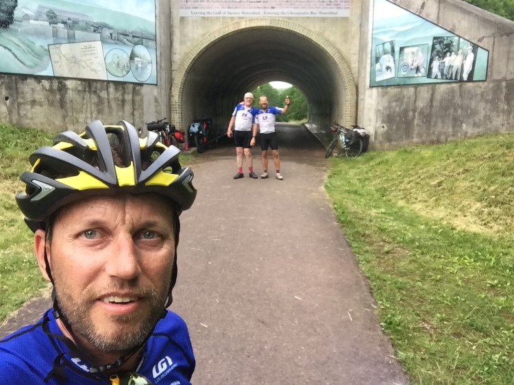
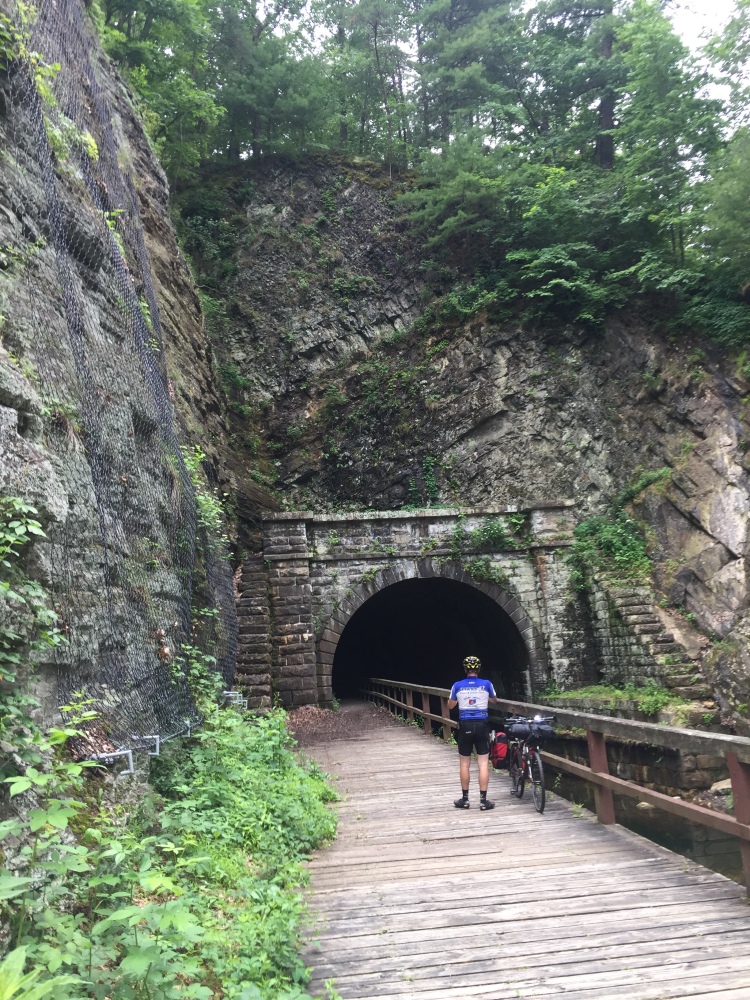
The trip through the Big Savage Tunnel was refreshingly cool and actually had many working lights in it so you could see where you were going… which is always a plus. The riding surface was pretty decent in this tunnel as well.
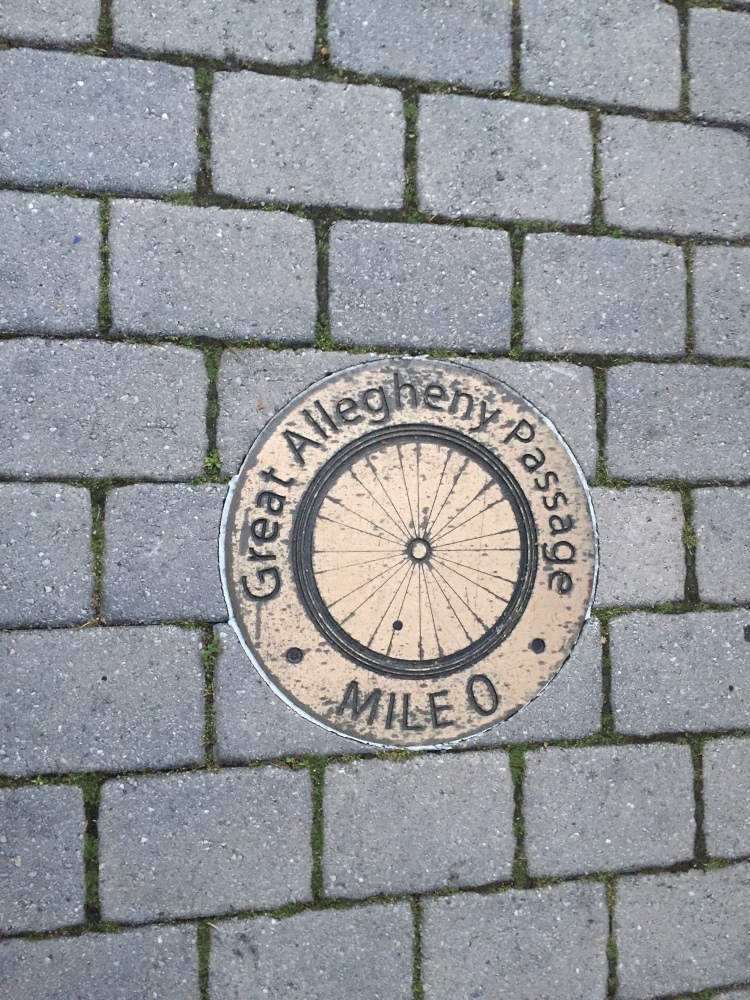
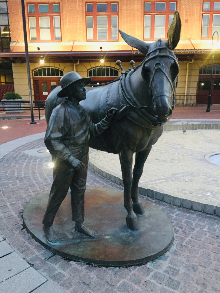
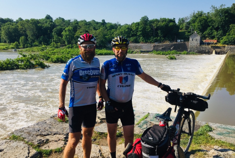
We made it to downtown Cumberland and mile marker 0 before it got dark, but not by much. We debated about getting a hotel in Cumberland, but we decided we had hauled all of our camping gear this far and that we should be using it. So we headed east out of Cumberland with our lights on looking for the first campsite we could find. As we rolled up to the first campsite we were greeted by a gentleman we would get to know pretty well over the next couple hours.

Day 3, Sunday June 19: After a good night sleep, Ron and I had the opportunity to discuss life, religion and future job possibilities. As we said goodbye to Ron we were sure to load him up with as much food and snacks we were able to spare.
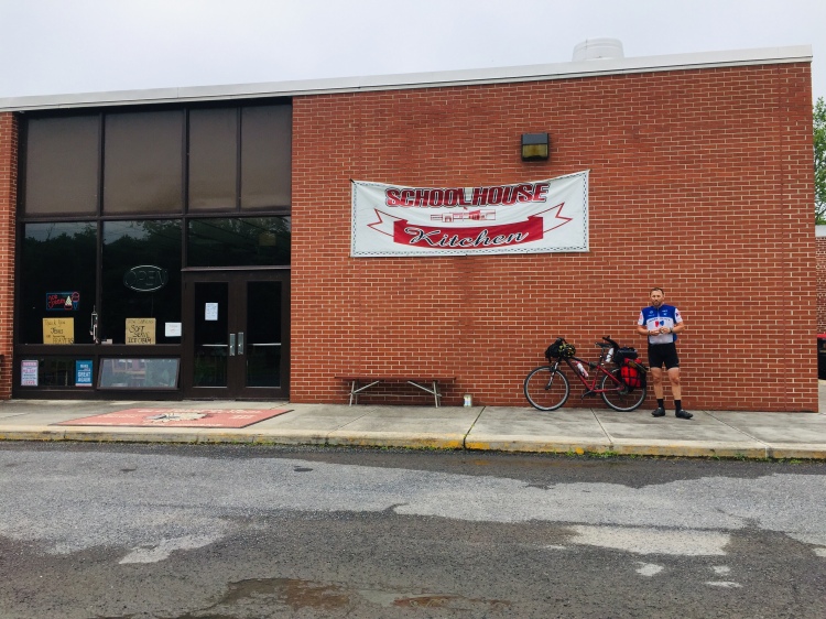
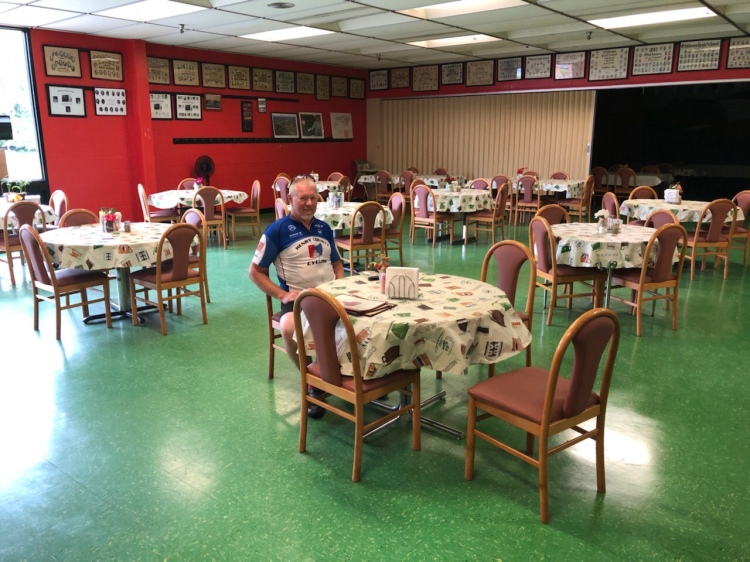
The C & O Canal Trail does not allow for signage to direct trail riders to lodging or restaurants, so be sure to bring a map on where to stop. We actually lucked out when we looked at a map of this area and saw we were close to the Schoolhouse Kitchen so we decided to stop. What a hidden gem this place was in the middle of nowhere. It was an old high school that they turned into a uniquely designed restaurant which served all kinds of home cooked food. It definitely hit the spot for our Father’s Day breakfast.

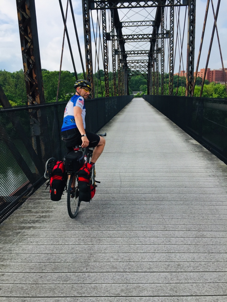
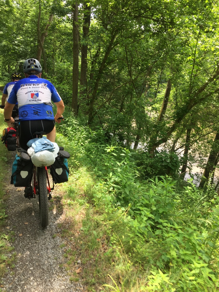
As we continued to travel on the C & O Canal Trail, the riding surface became much rougher. For the most part, the trail was a 2 track muddy lane with occasional rocks causing a much rougher ride and more stress on our bikes and especially my spokes. I ended up breaking 3 spokes on the C & O Canal trail alone, but that might have had a lot to do with me carrying too much weight on the rear of my bike.

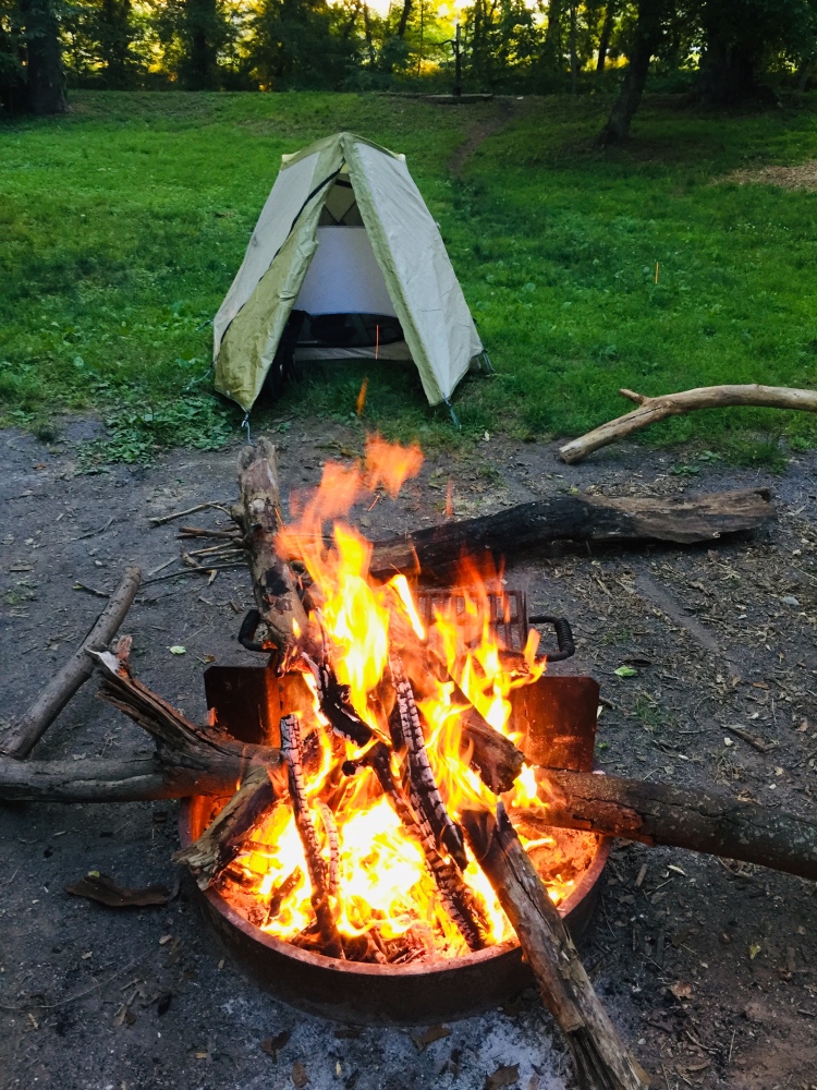
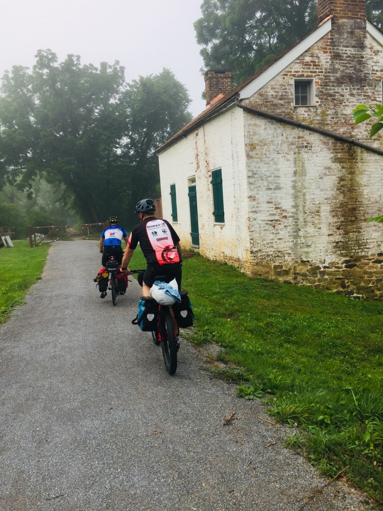
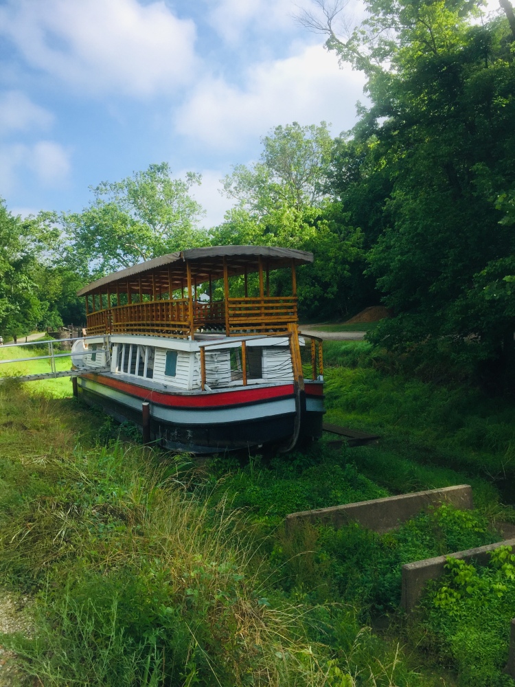
The C & O Canal Trail riding surface is not as well maintained as the GAP trail with it’s crushed cinders, but the C & O has it own bike-in campsites that each provide a fire ring, serviced & clean Porta-johns, and potable drink water that you just have to prime the pump to get it flowing. We pulled into a campsite a few miles short of Williamsport, Maryland. We set up our tents and unloaded our bikes and headed into town for some pizza and checkout out the Civil War era park near downtown. Doubleday Hill Monument commemorates the crossing of the Potomac River and occupation of the hill by Major General Abner Doubleday. The monument, also known as Doubleday Hill, overlooks the Potomac River into West Virginia.

Day 4, Monday June 20: Today we would continue along the Potomac to Antietam Battlefield and take a step back in time to September 17, 1862.
As you can see there is not a lot of room between the C & O Canal Trail and the Potomac River. One small mistake and you are getting wet on either side. We did encounter two gentlemen on horseback on the trail. As we neared the horses, we slowed down, but it still spooked the horses…especially the front horse. It reared back with it’s rider on it and somehow the rider was able to calm the startled horse before it lurched into the canal or dropped off the steep riverbank into the Potomac. As this was happening we had come to a complete stop and listened to every suggestion the riders made to help calm the startled horse. Eventually order was maintained and we continued on and wished them luck the rest of their ride. We later joked that our wives might not have believed us if we told them we almost got kicked by a rearing horse on this ride.
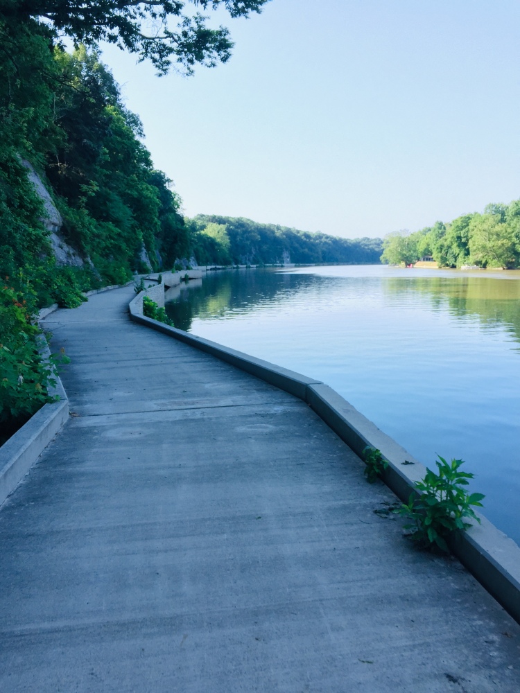
The slack water area along the Potomac was very cool. There was one section that washed out and was hard to get bikes through, but for the most part this area was like a boardwalk running along the river. This is another highlight of the trail for me probably my favorite part of the C & O portion of the trail.
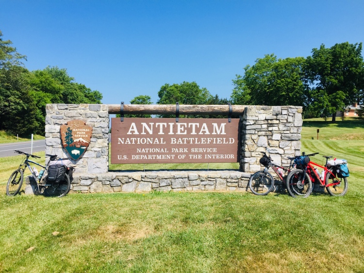
Antietam is situated just outside the small town of Sharpsburg, Maryland. This side trip was the one thing I really wanted to do since I enjoy walking back in history so much. I have been to Gettysburg, but Antietam was definitely on my battlefield bucket list. It was further off the trail than we originally thought, so it made for quite a long day and nearly 90 miles on the bike that day in total. The temperature was near 90 degrees all day long and the battlefield did not provide any shelter from the sun which is quite a contrast to the trail which is almost exclusively shaded.


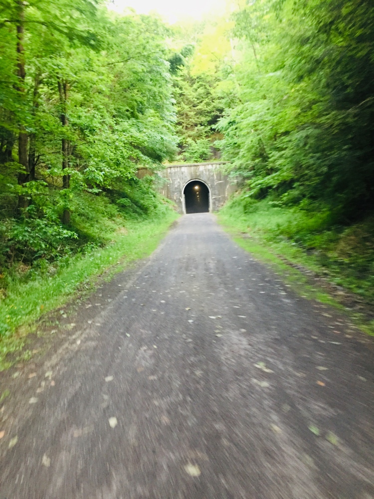
The Paw PawTunnel turned out to be pretty cool if you enjoy riding your bike in complete darkness on a rough surface. All joking aside, my headlight wasn’t strong enough to properly light-up the tunnel floor, so it kept me on my toes as I hit almost every mud puddle and pot hole in the blackened tunnel. They suggest you walk your bike through the tunnel, but we had a lot of ground to cover.
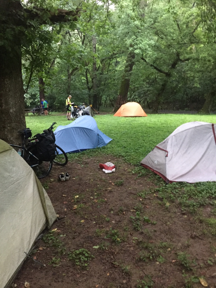
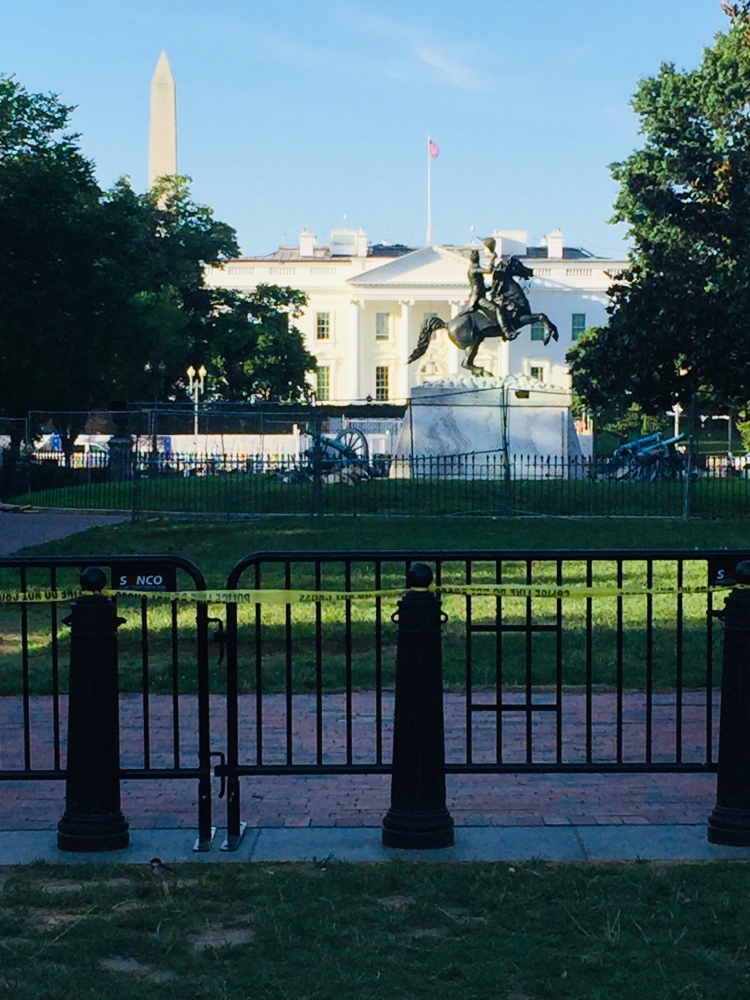
No more than we pulled into our final campsite and got our gear set up, did the sky finally open up and soaked us with a steady rain from 6:00 pm to 6:00 am. We did receive word from our wives that night that there were riots in Washington DC and they tried to tear the statue of Andrew Jackson down in Lafayette Square, just north of the White House. Our wives urged us to be careful as we finished the ride into DC. Most of our conversations that evening through our wet tent walls were centered around the following day and events we might encounter in Washington DC.
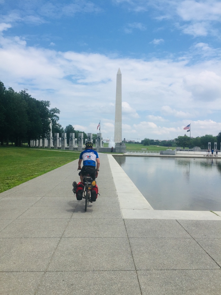
Day 5, Tuesday June 21: This would be the final day of our ride. The rain left the trail muddy, while a pretty heavy fog lingered as we headed towards Georgetown.


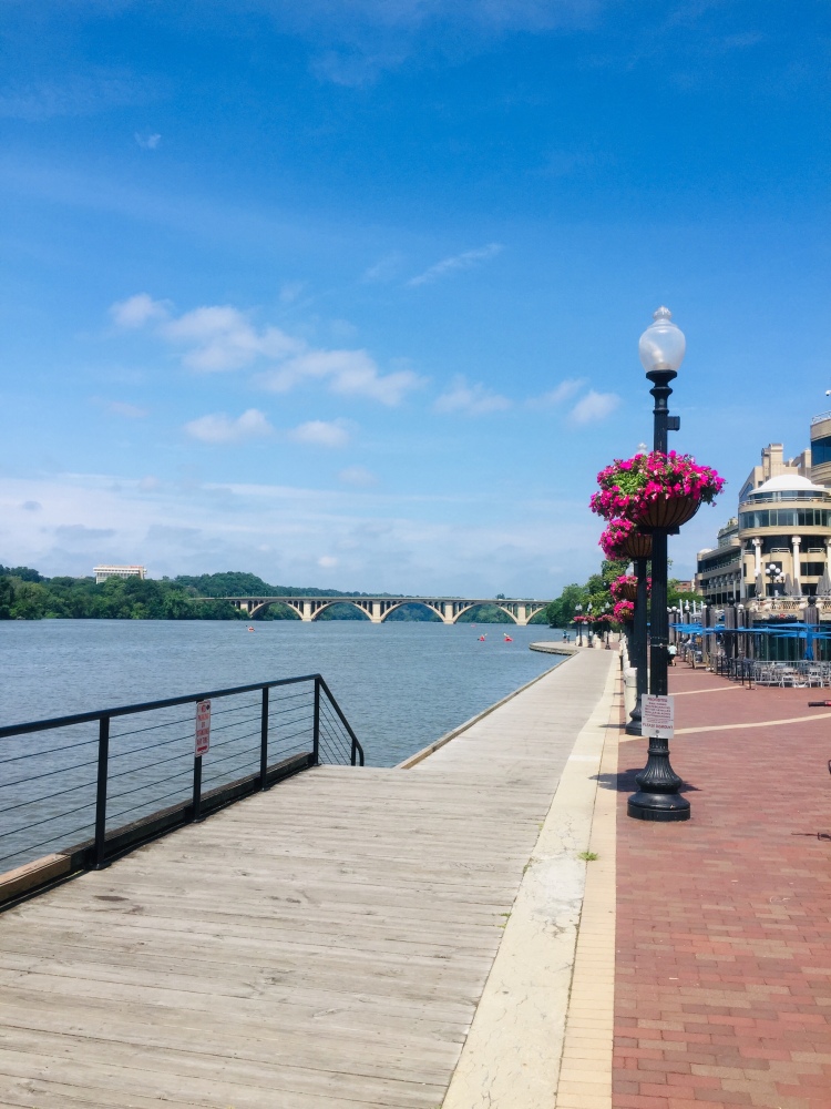
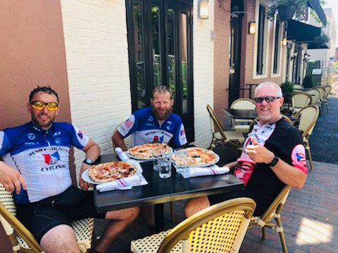
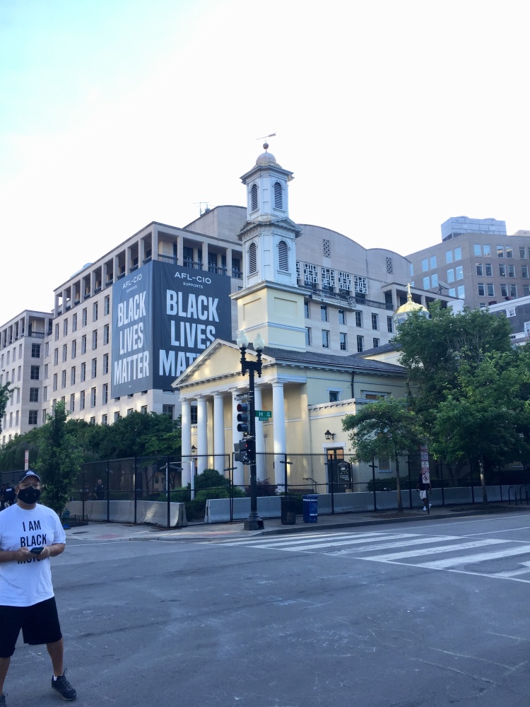
After finishing the GAP and C & O Canal Trails we headed to a nice Georgetown restaurant for some authentic Italian food at il Canale. We noticed the downtown shops were either boarded up or in the process of being boarded up from the rioting and looting the nights prior to our arrival. We stopped two guys who were coming back from fishing on the river and asked about the safety of visiting certain areas of the city. They told us the National Mall was essentially abandoned and no-one was there and that it was safe to visit. They also mentioned so stay clear of the area north of the White House near Lafayette Square where there were Black Lives Matters protests and the protesters tried to tear down the statue of Andrew Jackson two night prior. They said this area is fine during the day light hours, but in order to be safe we should avoid this area after dark. It so happened that our hotel was 4 blocks away from this active area and we were about to find out what all the fuss was about.
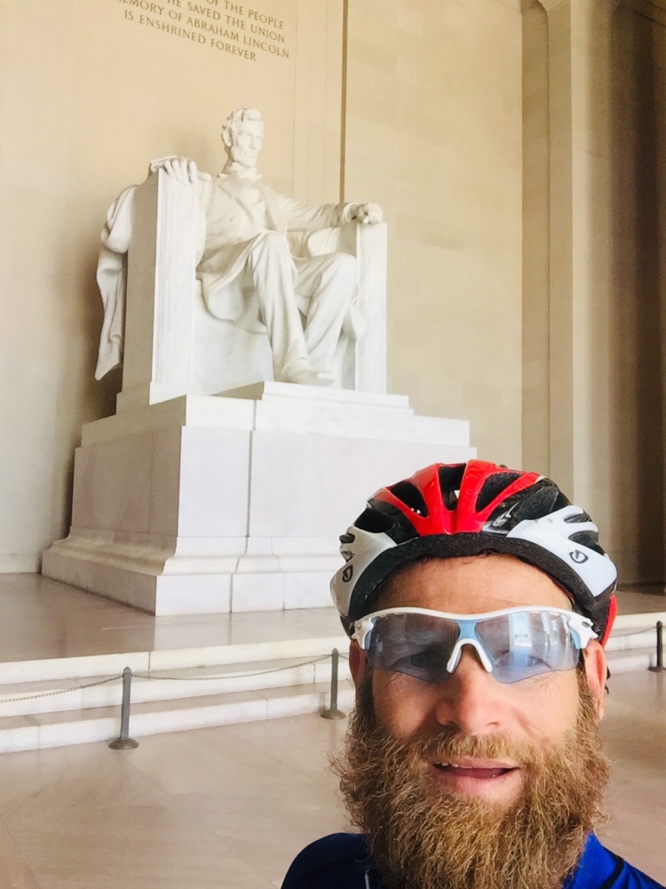
Our trip through the National Mall in Washington DC was a dream come true. Two of us had already been to the National Mall prior, while the other it was his first visit. We explained how the last time we had visited every monument had people everywhere and you had to wait patiently to even get to the front of the line to see them. This time however, the place was left almost to ourselves. Many of the monuments we were the only visitors there. The rioting and protesting had scared everyone away that wasn’t already scared of the Covid lockdowns in the city.
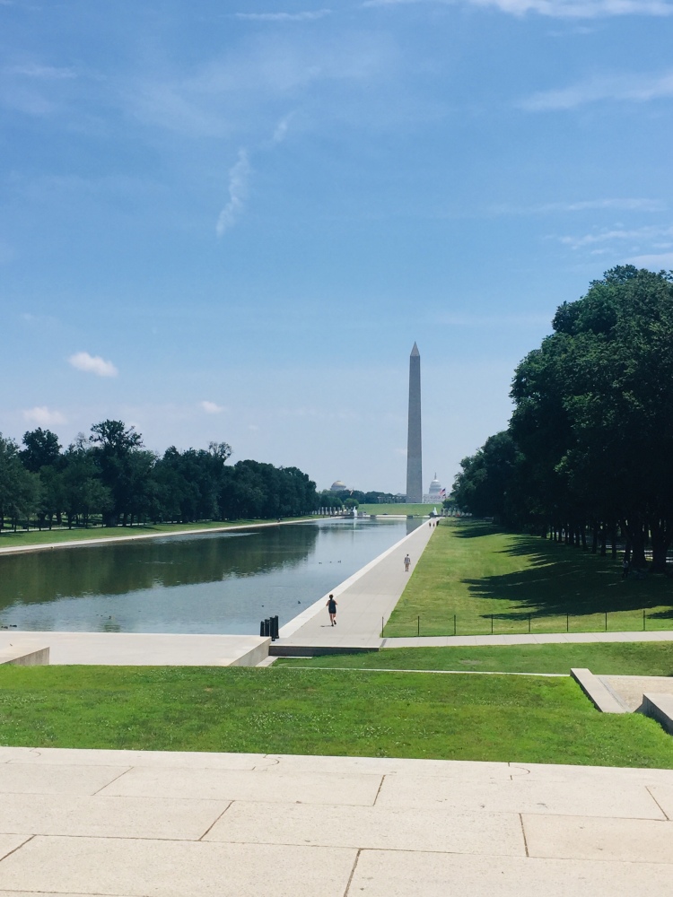


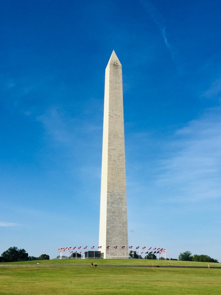
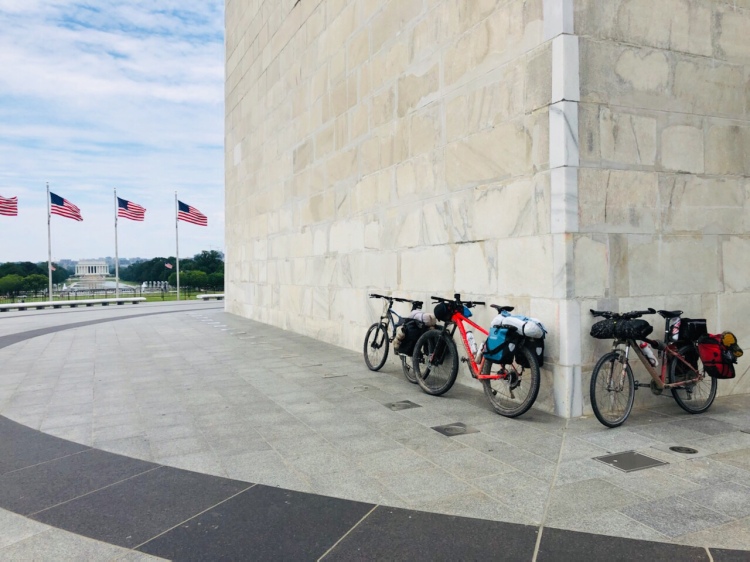
As you can see from the pictures, the National Mall was nearly deserted except for a few National Parks Service workers, who were all so nice and willing to talk about everything going on in the city.
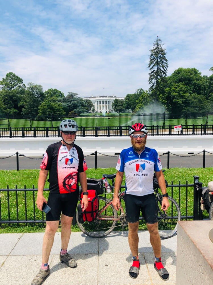
So after some discussion we decided we would just see how close we could get to the White House. The picture above is from the south lawn and that was about as close as you were going to get to either for south or the north lawn. We actually had White House security come up and check us out from a few yards away to make sure we were really just crazy mountain bikers on a tour, rather than someone meant to do harm with our bikes loaded with heavy panniers.

So after navigating the streets around the east side of the White House we found the newly painted and coined Black Lives Matter Plaza. To be honest, I was quite surprised how civil and uneventful it seemed. There were many girls taking selfies for their latest social media posts. There were a few protestors hanging around, but there were quite a few families with kids hanging around too.
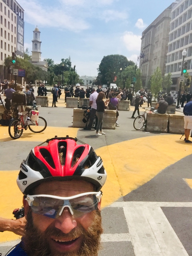

After getting cleaned up and putting our bikes away, we decided to venture back down to check out the protest again since it was getting closer to dark. This time it was getting a little more intense. There was a live network tv camera broadcasting the events as they were unfolding. The protestors were getting up in the faces of the police and screaming obscenities at them. For us it was time to head back to the hotel and not get involved in anything that was going to happen after dark.
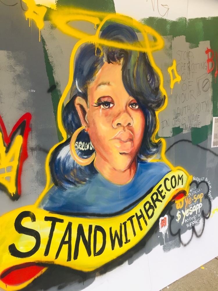

A couple of beers and then some time to people watching those who were heading to the protest. The local police had informed us earlier that nearly all of the protestors were bussed in from outside of the DC area and they knew that these protestors would be here for the next couple of weeks and even months. This was interesting news that you sometimes don’t get from the media. Hearing information from people who live it day in and day out still goes a long way in my book.
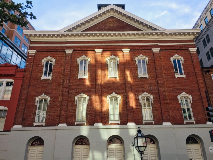
Day Z, Wednesday June 24: After a good night sleep, we had to wait until the rental car company opened up, so we walked to the Capital Building and past a few more sights like Ford Theater, the sight of President Lincoln’s assignation. Once our rental car was secured, we carefully disassembled our bikes and gently tucked them into our new ride for the trip back to Pittsburgh.

I hope you enjoyed hearing the story of our nearly weeklong journey through the rural countryside of Pennsylvania and Maryland along the GAP and C&O Canal Trails. If you don’t want to read the whole post, here is a video link to our Gap and C&O Trail Ride.


Looks like you guys had a great time. What an amazing trip! The scenery is beautiful there.
LikeLiked by 1 person
The scenery near Ohiopyle was simply amazing.
LikeLiked by 3 people
Wow, what an adventure! Very neat! Thanks so much for sharing.
LikeLiked by 2 people
This trip was awesome. A bucket list ride for any cyclist.
LikeLiked by 2 people
very nice ty
LikeLiked by 3 people
Such a fun ride
LikeLiked by 2 people
Never in my life did I think I would be reading about a biking adventure of someone I didn’t know IRL, but this was fantastic and the photos were great!
LikeLiked by 3 people
What bike adventures have you been on?
LikeLiked by 3 people
None 😆, which is why I found your post so fascinating 👏
LikeLiked by 2 people
You’ll love it any make great memories along the way. It won’t all be all sunshine and rainbows though. You have to have some rough times to enjoy the good times.
LikeLiked by 2 people
It must have been a great experience!
LikeLiked by 3 people
It was a blast. So many stories
LikeLiked by 3 people
It felt like I just travelled with your team! And that bicycle tree😮😂
LikeLiked by 2 people
It was a blast. Time to start planning for the next ride.
LikeLiked by 2 people